Currently Empty: 0,00 €
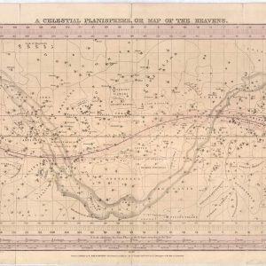
Chart the Night Sky with 19th-Century Astronomy Embark on a cosmic journey back to the early nineteenth century with this rare reproduction of F.J. Huntington’s “A Celestial Planisphere.” This ...
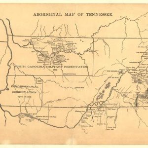
Uncover the Ancestral Frontiers of Early Tennessee Delve deep into Southern history with this compelling reproduction of the 1888 “Aboriginal Map of Tennessee.” This specialized cartographic study illustrates the ...
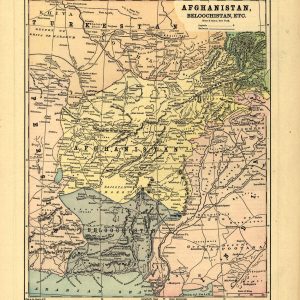
Explore the Geopolitics of Central Asia’s Great Game Immerse your space in late-nineteenth-century history with this detailed reproduction of Hunt & Eaton’s 1893 map titled “Afghanistan, Beloochistan, Etc.” Published ...
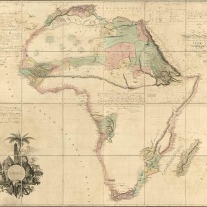
Chart the Dawn of African Interior Exploration Delve into the historic age of discovery with this extraordinary reproduction of Aaron Arrowsmith’s iconic 1802 wall map of Africa. Commissioned during ...
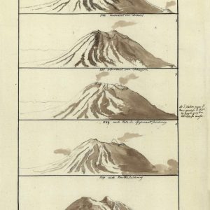
A Rare Academic Record of Early Volcanology and Science Delve into the fascinating origins of modern geology with this unique 1802 scientific chart titled “Ages du Volcan de Bourbon.” ...
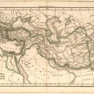
A Historical Journey Through Alexander the Great’s Conquests Step into antiquity with this fascinating 1833 historical map created by the renowned French cartographer Felix Delamarche. Titled “Alexandri Magni Imperium ...

Discover the Art of 19th-Century Cartography Immerse yourself in history with this authentic reproduction of John Thomson’s 1813 masterpiece, capturing the Americas during a defining era of global exploration. ...
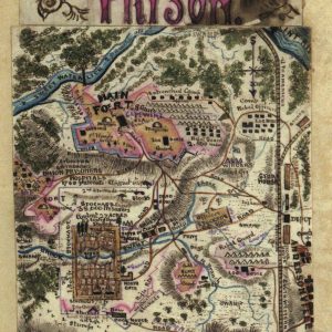
A Rare Eyewitness Cartographic Account of the American Civil War Immerse your historical collection in the raw reality of the American Civil War with this extraordinary hand-drawn map reproduction ...

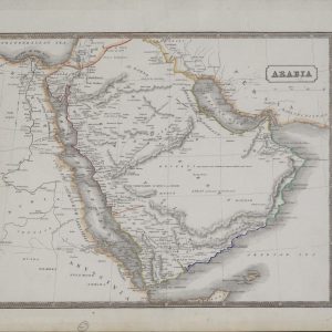
Discover the Masterpiece of Victorian Decorative Cartography Transform your interior space with a stunning piece of 19th-century history featuring this meticulously detailed 1851 map print of Arabia. Published by ...
Explore the Historic Crossroad of Continents and Desert Kingdoms Immerse your space in the rich, enigmatic history of the Middle East with this beautifully preserved 1863 map print of ...
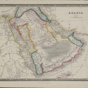
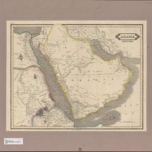
Journey Through the Desert Kingdoms of Pre-Modern Geographers Incorporate an authentic touch of global exploration into your home decor with this pristine 1831 map print of the Arabian Peninsula. ...
Trace the Ancient Crossroads of Northeast Africa and the Middle East Immerse your space in the historical geography of the early 19th century with this remarkably detailed 1840 map ...

Chart the Geographic Vastness of the Great Arabian Deserts Enhance your wall decor with a striking piece of late Victorian cartography featuring this exceptionally detailed 1885 map print of ...
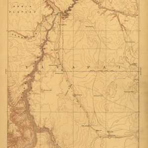
Discover the Rugged Topography of the Wild American West Bring the raw, untamed beauty of early American exploration to your walls with this exceptional 1886 reconnaissance map of the ...
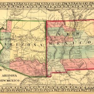
Trace the Historic Frontiers of the Old American Southwest Immerse your space in the legendary history of the American frontier with this vibrant 1867 map print of the Arizona ...

Discover the Golden Age of early American Atlas Cartography Incorporate a rare piece of early American publishing history into your interior design with this remarkable 1814 map of Asia, ...

Trace the Historic Borders of Imperial Empires and Kingdoms Embark on a visual journey across the largest continent on Earth with this stunning 1814 hand-colored political map of Asia, ...
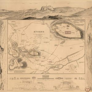
Explore the Cradle of Western Civilization through Classical Cartography Bring the grandeur of ancient Greece into your home with this exquisite 1832 archaeological map of Athens, published under the ...

Nineteenth-Century Copperplate Engraving of Australasia and New Holland This exceptional 1818 hand-colored map, compiled by renowned cartographer John Pinkerton, provides a rare historical perspective of the South Pacific and ...

American Civil War Military Cartography and Strategic Fortifications This rare historical document serves as a tactical visual reference from the early years of the American Civil War, specifically detailing ...
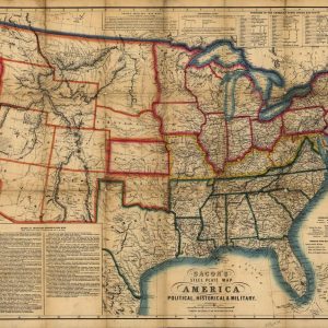
Historical Civil War Map of the United States This antique lithograph showcases a rare 1863 steel plate map of America, subtitled Political, Historical, and Military, published in London by ...
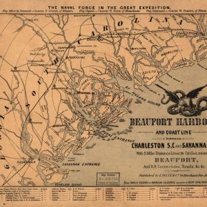
Historical Civil War Naval Map of Beaufort Harbor This antique 1862 map captures the strategic coastal region of Beaufort Harbor during the American Civil War, detailing the coastline between ...
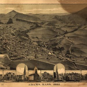
A Gilded Age Perspective of New England Valley History Capture the timeless appeal of historic New England with this masterfully restored 1882 bird’s-eye view map of Adams, Massachusetts. Nestled ...
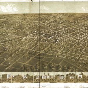
A Panoramic Glimpse of Post-Civil War Michigan Architecture Immerse your space in the historical narrative of the American Midwest with this expertly restored 1866 panoramic map of Adrian, Michigan. ...