Currently Empty: 0,00 €
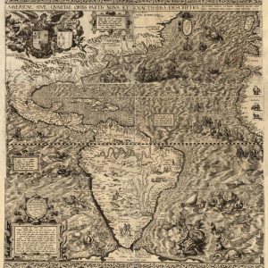
Americae sive qvartae orbis partis nova et exactissima descriptio English title: America, or the fourth part of the world, newly and most accurately described. Names Gutiérrez, Diego, active 1554-1569. ...
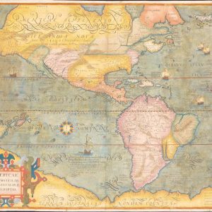
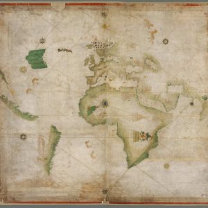
Americae et proximar regionvm orae descriptio. Relief shown pictorially. Prime meridian: Ferro. Second state. Available also through the Library of Congress Web site as a raster image.

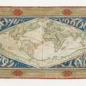
Quam hic vides orbis imagine English: How do you see the world in this image?
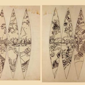
Proof sheets for celestial globes, created by the German cartographer Johann Schöner, a prominent astronomer and mathematician. These buttons are considered the oldest known celestial buttons. They were found ...
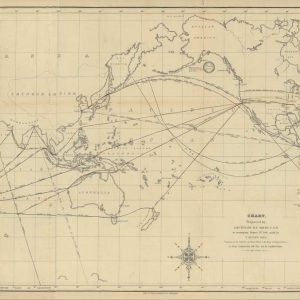
Nineteenth-Century Hydrography and Global Maritime Trade Networks This authentic antique world chart, prepared in 1848 by the prominent American oceanographer Lieutenant Matthew Fontaine Maury, illustrates the strategic commercial pathways ...

A New, More True and Complete Description of the Whole World, First Published by Alonzo de Santa Cruz, Principal Cosmographer to Emperor Charles V, 1542. Other Title Nova verior ...

Noua, et integra uniuersi orbis descriptio (A new and complete description of the whole world).
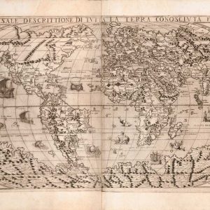
Universale descrittione di tutta la terra conosciuta fin qui. English: Universal description of all the earth known to date.
Map Sampler, An Outline Map of the World for Ladies Needlework and Young Students of Geography, 1798
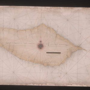
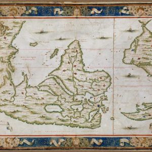
Atlas of the Azores and Madeira Islands. This 16th-century pen-and-ink watercolor map, from an atlas of Madeira and the Azores, shows the island of Madeira. This island was discovered ...
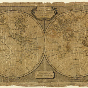
Map Sampler, An Outline Map of the World for Ladies Needlework and Young Students of Geography, 1798
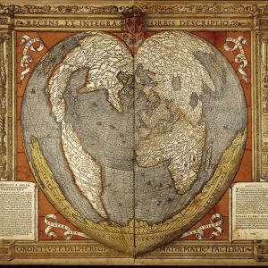
A Modern and Complete Map of the World by the Royal Mathematician Oronce Fine of the Dauphiné. An astronomer and mathematician, from 1531 the first chair of mathematics in ...
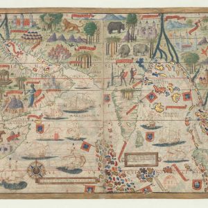
Nautical Atlas of the World, Folio 6 Recto, North Atlantic Ocean. The map presented here is from the Miller Atlas in the collections of the National Library of France. ...
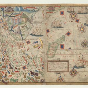
Nautical Atlas of the World, Folio 6 Verso, The Mediterranean Sea. The map presented here is from the Miller Atlas in the collections of the National Library of France. ...
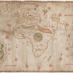
This nautical map of the world was produced by the Genoese cartographer Nicolo di Caverio based on Portuguese documents. The map can be dated to 1506, as it contains ...
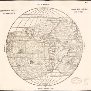
Universale della nuovamente parte del mondo ritrovata.
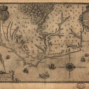
Americæ pars, nunc Virginia dicta : primum ab Anglis inuenta, sumtibus Dn. Walteri Raleigh, Equestris ordinis Viri, Anno Dn̄i. MDLXXXV regni Vero Sereniss. nostræ Reginæ Elisabethæ XXVII, hujus vero ...
The first maritime charts were produced at the turn of the 13th and 14th centuries. Their main purpose was to represent with the greatest possible accuracy coastlines and ports, ...
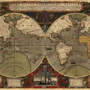
Cosmographical Map or Universal Description of the World with the Actual Path of the Winds. Other Title Carte cosmographique ou universelle description du monde avec le vrai traict des ...
Shows routes around the world of Sir Francis Drake between 1577 and 1580 and Thomas Cavendish between 1586 and 1588. Available also through the Library of Congress Web site ...
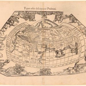
Typus orbis descriptione Ptolemaei. Title in English: Image (or model) of the world according to Ptolemy’s description. Names Fries, Lorenz, approximately 1490-1531, cartographer. Trechsel, Gaspard, active 1529-1549, printer. Ptolemy, ...

Title: Die neuwen Inseln, so hinder Hispanien gegen Orient bey dem land India ligen (The newly discovered islands that lie beyond Spain, toward the Orient, near the land of ...
This portolan world map, drawn by Nicolas Desliens in 1566, synthesizes Norman hydrographic knowledge in the mid-16th century. It is one of two world maps by Desliens known to ...
- 1
- 2