Currently Empty: 0,00 €
0 Comments
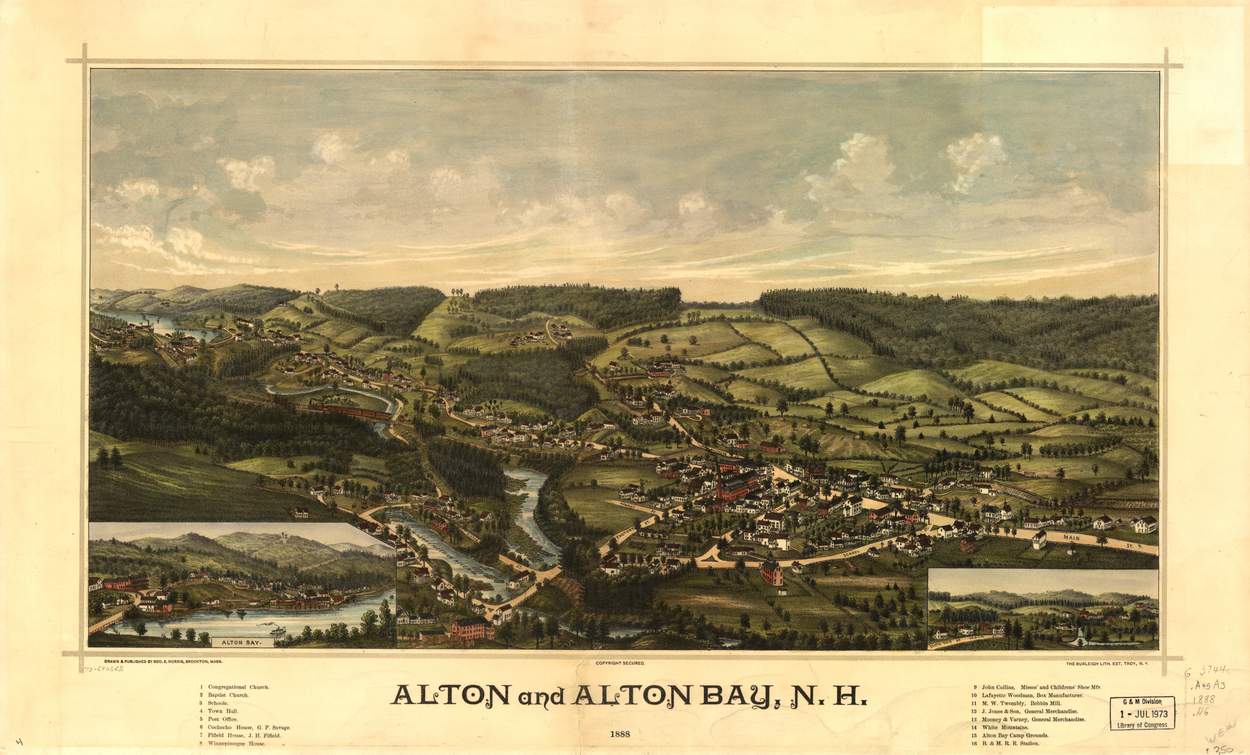
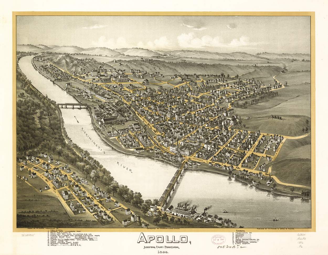
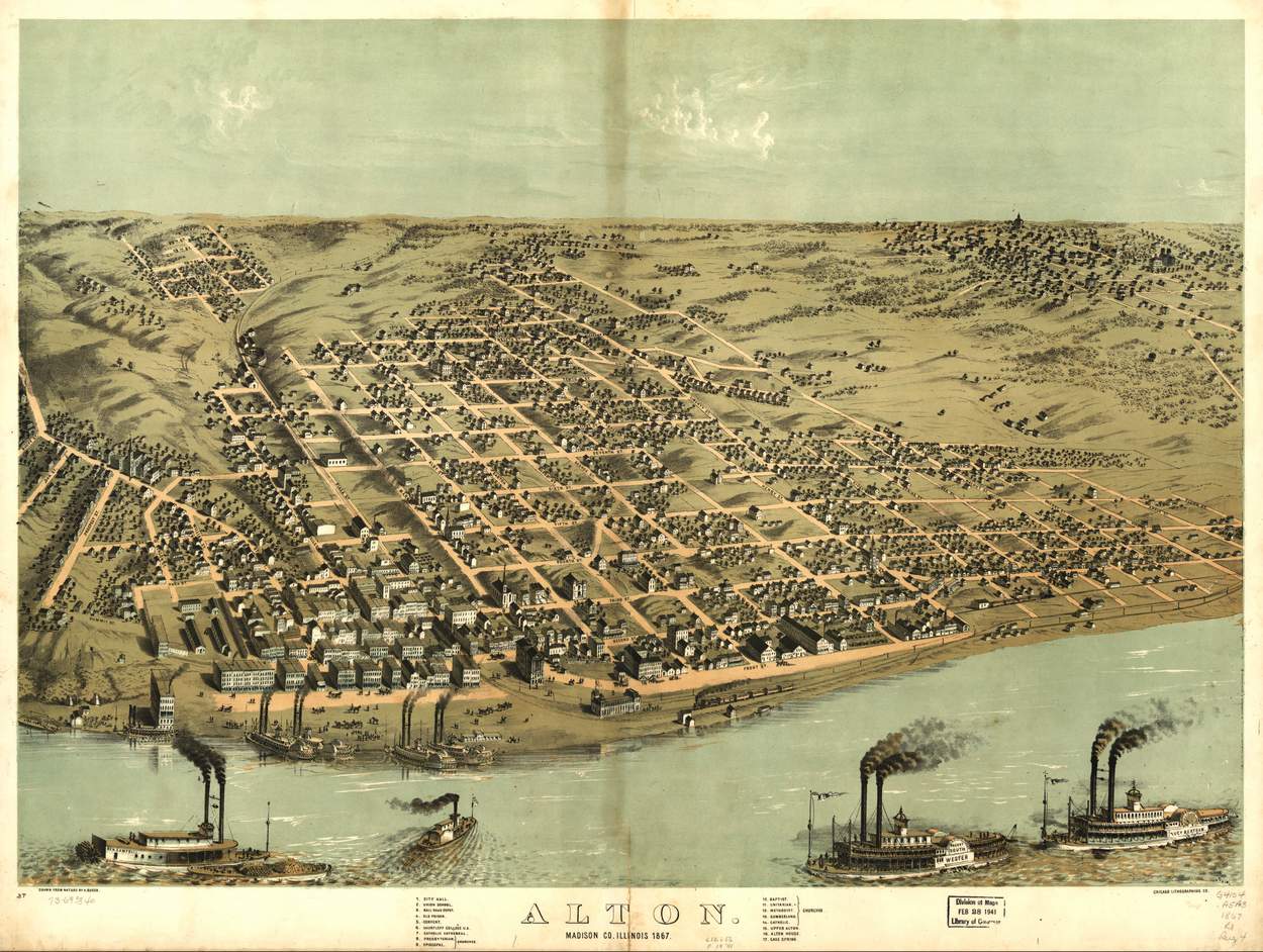
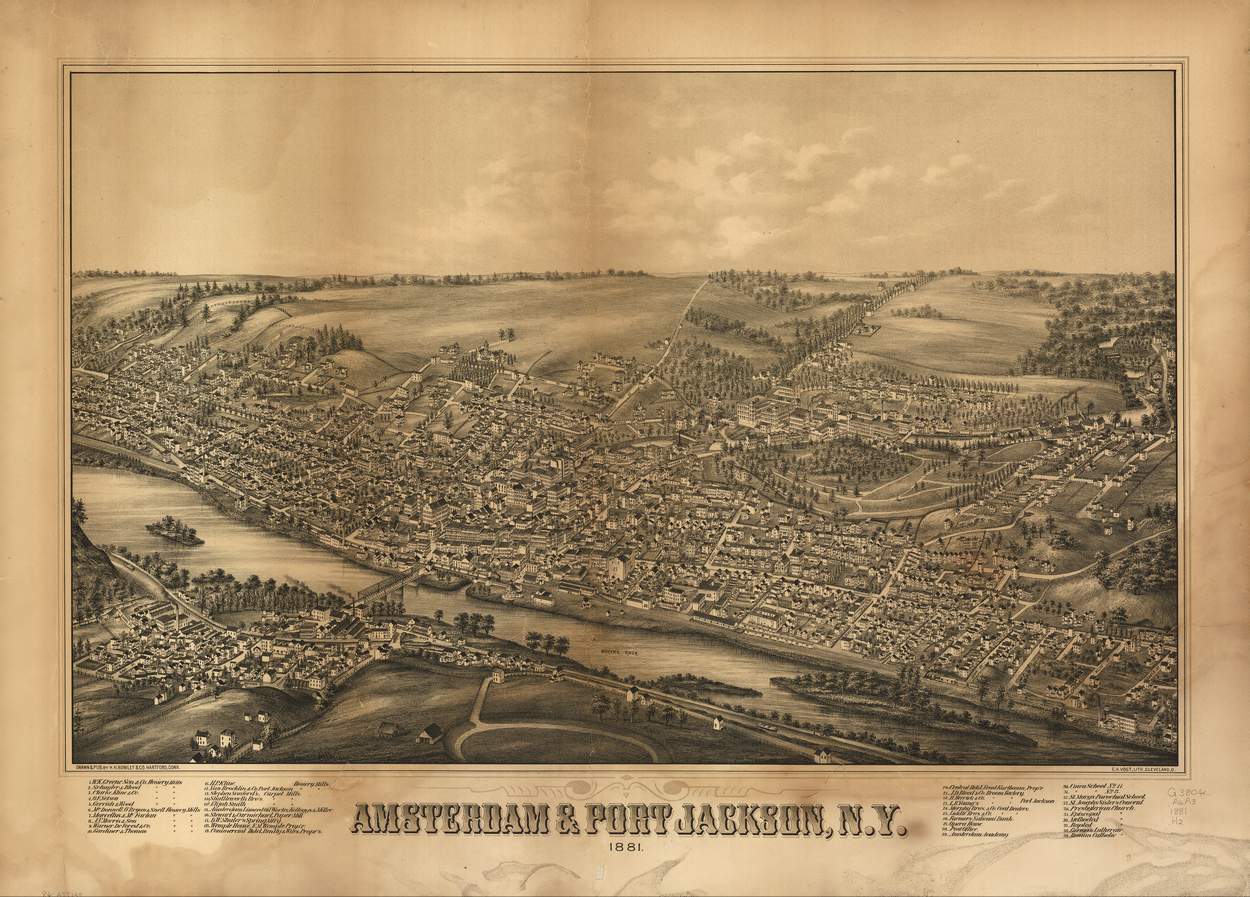
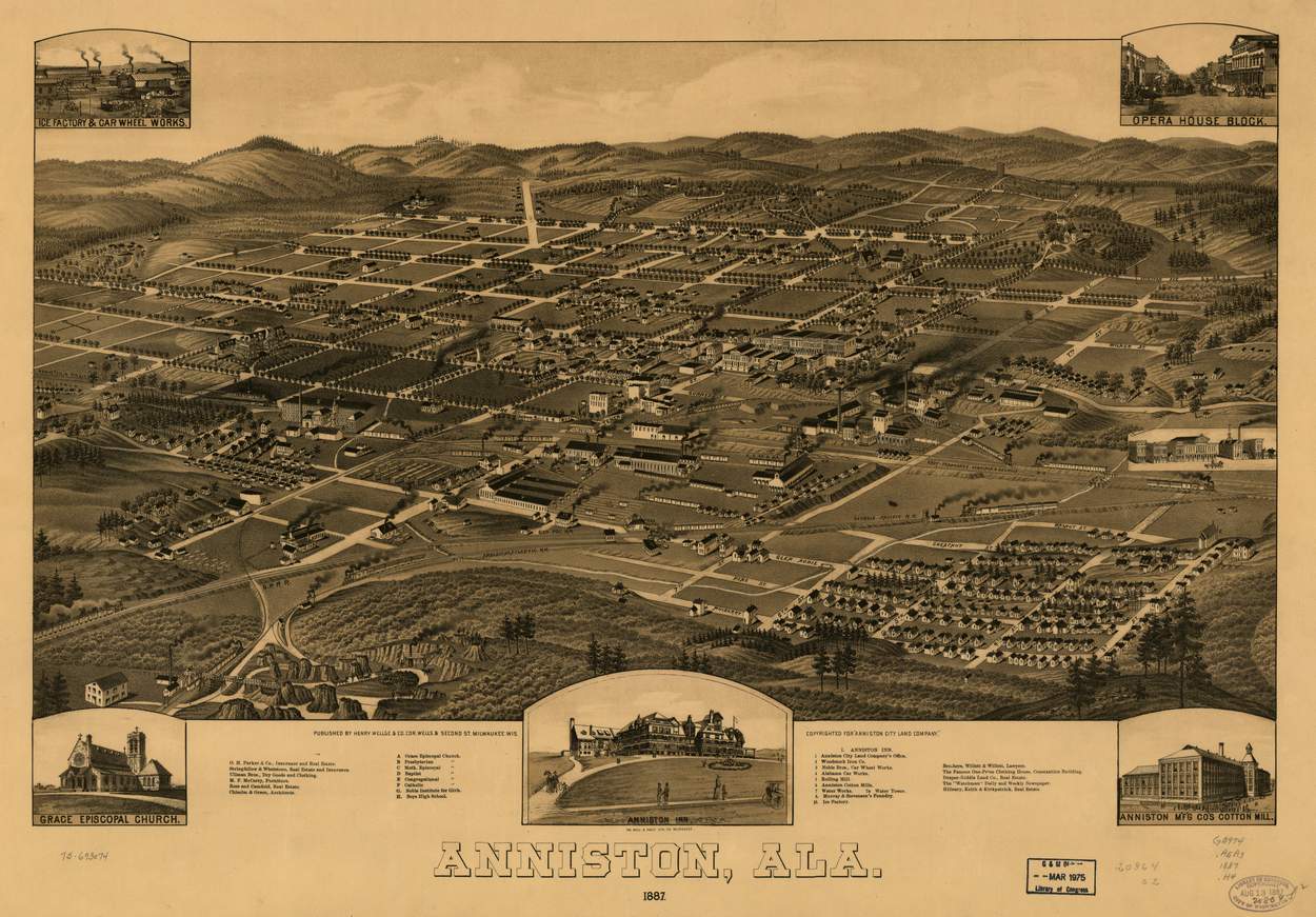
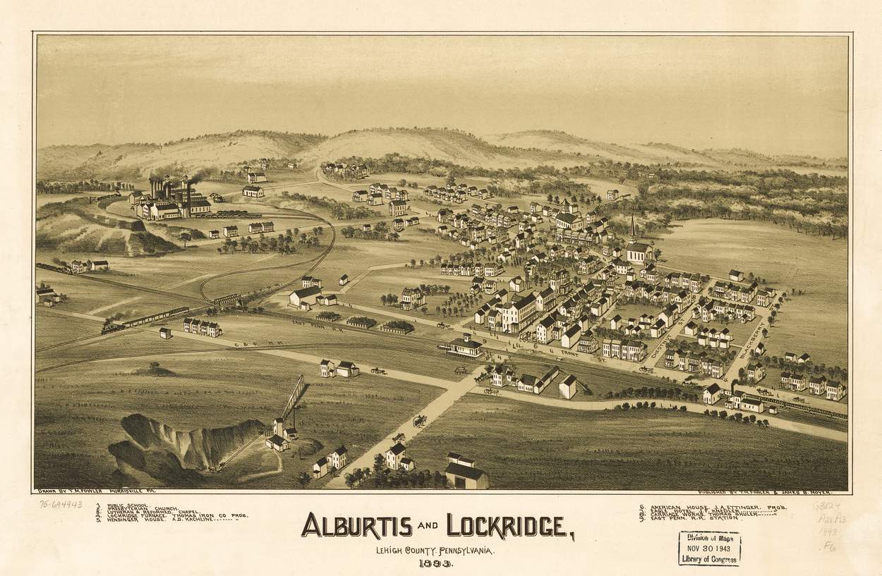
Bird’s-Eye View Maps in 19th-Century America
During the 19th century, a remarkable form of cartographic art flourished across the United States: the bird’s-eye view map. Also known as panoramic maps or perspective maps, these images depicted cities, towns, and landscapes as if seen from an elevated, oblique angle—long before airplanes or drones made such perspectives possible. They combined elements of art, geography, and imagination, creating a vivid visual record of urban America during a time of rapid expansion and industrialization.
Bird’s-eye view maps let 19th-century Americans see their towns from above, blending art, imagination, and a vision of progress.
Artistic Vision and Technique
Unlike traditional topographic maps, bird’s-eye views were not drawn to scale. Instead, artists created the illusion of depth and perspective by combining measured plans with artistic license. Draftsmen often climbed church towers, hills, or specially built platforms to sketch outlines of the town. Later, they used these sketches to produce detailed lithographs that included streets, buildings, rivers, railroads, and landmarks. Every detail—from church steeples to factory chimneys—was rendered with care, giving each map a sense of life and activity.
A Tool of Promotion and Pride
Bird’s-eye view maps were more than just art; they were promotional tools. During the late 1800s, American towns were eager to attract settlers, investors, and industries. A beautifully illustrated view of a growing town symbolized prosperity and modernity. Publishers often sold copies to local businesses, which sometimes paid extra to have their names or storefronts highlighted on the print. In this way, these maps became both a source of civic pride and a marketing instrument for urban development.
Technology and Distribution
The popularity of bird’s-eye views coincided with advances in lithographic printing, which made it possible to produce large, detailed images at relatively low cost. Major publishers such as Currier & Ives, J. J. Stoner, and Henry Wellge created thousands of these maps between the 1840s and the early 1900s. They were sold by subscription, mailed across the country, and displayed in homes, schools, and public buildings.
Cultural and Historical Value
Today, these maps serve as valuable historical documents. They capture towns at a specific moment in time—often before later urban redevelopment transformed their landscapes. Historians, geographers, and genealogists use them to study urban growth, transportation networks, and architectural styles. Beyond their documentary value, they remain admired for their artistic beauty and craftsmanship, representing a unique intersection of art, commerce, and geography.
Legacy
By the early 20th century, the rise of aerial photography and more precise mapping techniques marked the decline of the bird’s-eye view tradition. Yet, their influence endures: modern digital mapping platforms, 3D models, and drone imagery can all trace part of their conceptual lineage back to these imaginative 19th-century works. The bird’s-eye view remains a powerful way to understand and visualize the human landscape—from the towns of frontier America to today’s virtual cities.