Currently Empty: 0,00 €
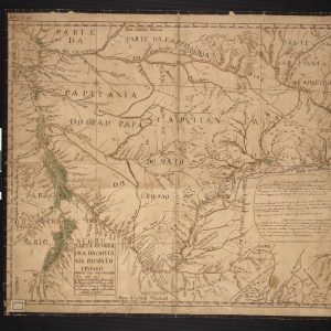
This hand-colored manuscript map shows the topography of the Brazilian state of Mato Grosso, along with parts of Grão Pará, the Negro River, Goiás, and São Paulo. It also ...

Relief shown by hachures. Covers also Uruguay and the Guianas. Also numbered “51”. From: New general atlas. (London : Printed for Longman, Rees, Orme, Brown and Green, 1830) Available ...
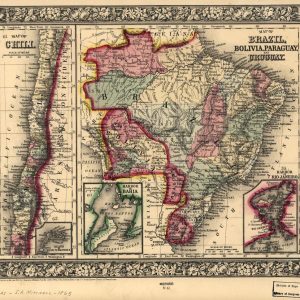
Map of Brazil, Bolivia, Paraguay, and Uruguay. Featured map of Chili. Relief shown by hachures. “Entered according to Act of Congress … 1870 by S. Augustus Mitchell, jr. … ...