Currently Empty: 0,00 €
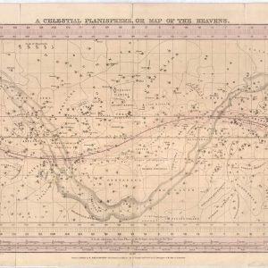
Chart the Night Sky with 19th-Century Astronomy Embark on a cosmic journey back to the early nineteenth century with this rare reproduction of F.J. Huntington’s “A Celestial Planisphere.” This ...
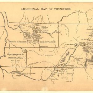
Uncover the Ancestral Frontiers of Early Tennessee Delve deep into Southern history with this compelling reproduction of the 1888 “Aboriginal Map of Tennessee.” This specialized cartographic study illustrates the ...
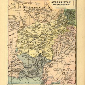
Explore the Geopolitics of Central Asia’s Great Game Immerse your space in late-nineteenth-century history with this detailed reproduction of Hunt & Eaton’s 1893 map titled “Afghanistan, Beloochistan, Etc.” Published ...
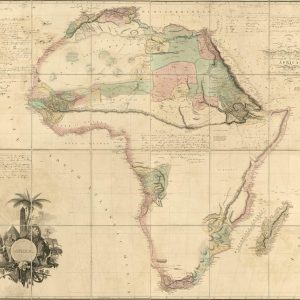
Chart the Dawn of African Interior Exploration Delve into the historic age of discovery with this extraordinary reproduction of Aaron Arrowsmith’s iconic 1802 wall map of Africa. Commissioned during ...
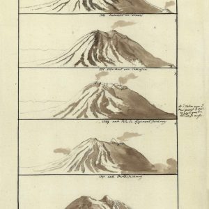
A Rare Academic Record of Early Volcanology and Science Delve into the fascinating origins of modern geology with this unique 1802 scientific chart titled “Ages du Volcan de Bourbon.” ...

Atlas pintoresco é histórico de los Estados Unidos Mexicanos. Names García Cubas, Antonio, 1832-1912. Source Collection Library of Congress Geography and Map Division Washington, D.C. 20540-4650 USA dcu
México, Debray Suc’s, c1884-86. Names García Cubas, Antonio, 1832-1912. Source Collection Library of Congress Geography and Map Division Washington, D.C. 20540-4650 USA dcu
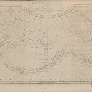
Maps of Alaska, from approximately 1568 to 1880 – AK Drawer 01 Folder 04. Source Collection Library of Congress Geography and Map Division Washington, D.C. 20540-4650 USA dcu
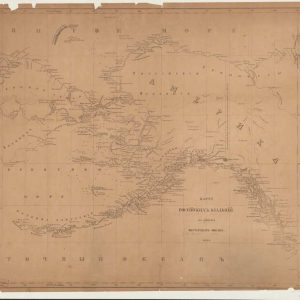
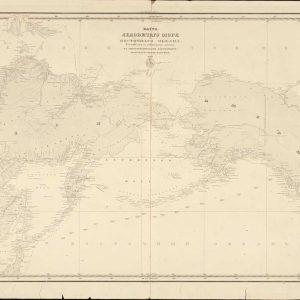
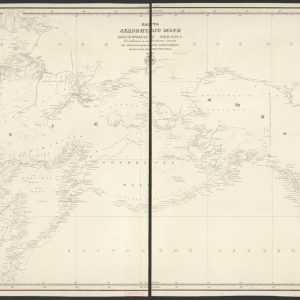
Maps of Alaska, from approximately 1568 to 1880 – Drawer 01 maps. Source Collection Library of Congress Geography and Map Division Washington, D.C. 20540-4650 USA dcu
Maps of Alaska, from approximately 1568 to 1880 – AK Drawer 01 Folder 12a Item 01. Source Collection Library of Congress Geography and Map Division Washington, D.C. 20540-4650 USA ...
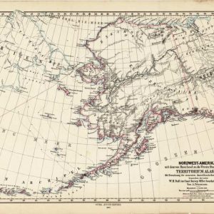
Maps of Alaska, from approximately 1568 to 1880 – AK Drawer 01 Folder 06. Source Collection Library of Congress Geography and Map Division Washington, D.C. 20540-4650 USA dcu
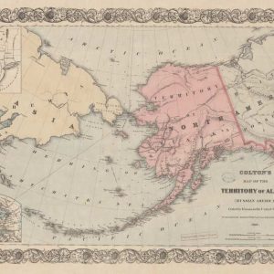
Maps of Alaska, from approximately 1568 to 1880 – AK Drawer 01 Folder 22. Source Collection Library of Congress Geography and Map Division Washington, D.C. 20540-4650 USA dcu
Maps of Alaska, from approximately 1568 to 1880 – AK Drawer 01 Folder 17 Item 01. Source Collection Library of Congress Geography and Map Division Washington, D.C. 20540-4650 USA ...
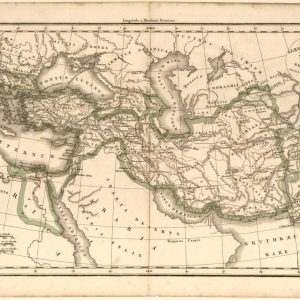
A Historical Journey Through Alexander the Great’s Conquests Step into antiquity with this fascinating 1833 historical map created by the renowned French cartographer Felix Delamarche. Titled “Alexandri Magni Imperium ...
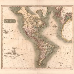
Discover the Art of 19th-Century Cartography Immerse yourself in history with this authentic reproduction of John Thomson’s 1813 masterpiece, capturing the Americas during a defining era of global exploration. ...
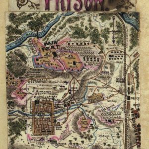
A Rare Eyewitness Cartographic Account of the American Civil War Immerse your historical collection in the raw reality of the American Civil War with this extraordinary hand-drawn map reproduction ...
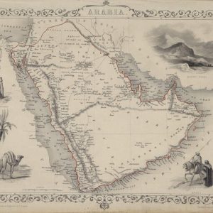
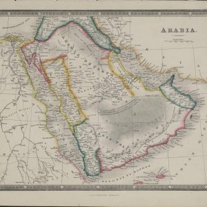
Discover the Masterpiece of Victorian Decorative Cartography Transform your interior space with a stunning piece of 19th-century history featuring this meticulously detailed 1851 map print of Arabia. Published by ...
Explore the Historic Crossroad of Continents and Desert Kingdoms Immerse your space in the rich, enigmatic history of the Middle East with this beautifully preserved 1863 map print of ...
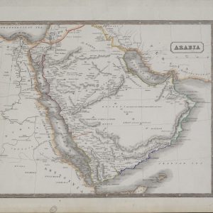
Journey Through the Desert Kingdoms of Pre-Modern Geographers Incorporate an authentic touch of global exploration into your home decor with this pristine 1831 map print of the Arabian Peninsula. ...
Trace the Ancient Crossroads of Northeast Africa and the Middle East Immerse your space in the historical geography of the early 19th century with this remarkably detailed 1840 map ...
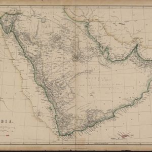
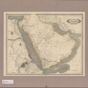
Chart the Geographic Vastness of the Great Arabian Deserts Enhance your wall decor with a striking piece of late Victorian cartography featuring this exceptionally detailed 1885 map print of ...
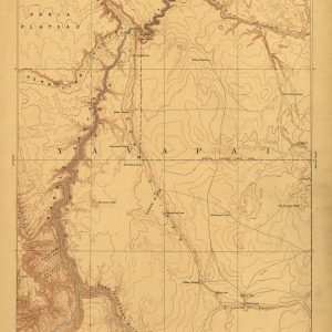
Discover the Rugged Topography of the Wild American West Bring the raw, untamed beauty of early American exploration to your walls with this exceptional 1886 reconnaissance map of the ...
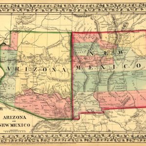
Trace the Historic Frontiers of the Old American Southwest Immerse your space in the legendary history of the American frontier with this vibrant 1867 map print of the Arizona ...

Discover the Golden Age of early American Atlas Cartography Incorporate a rare piece of early American publishing history into your interior design with this remarkable 1814 map of Asia, ...