Currently Empty: 0,00 €
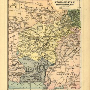
Explore the Geopolitics of Central Asia’s Great Game Immerse your space in late-nineteenth-century history with this detailed reproduction of Hunt & Eaton’s 1893 map titled “Afghanistan, Beloochistan, Etc.” Published ...
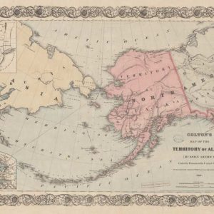
Maps of Alaska, from approximately 1568 to 1880 – AK Drawer 01 Folder 17 Item 01. Source Collection Library of Congress Geography and Map Division Washington, D.C. 20540-4650 USA ...

Discover the Golden Age of early American Atlas Cartography Incorporate a rare piece of early American publishing history into your interior design with this remarkable 1814 map of Asia, ...
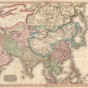
Trace the Historic Borders of Imperial Empires and Kingdoms Embark on a visual journey across the largest continent on Earth with this stunning 1814 hand-colored political map of Asia, ...
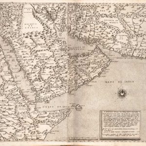
Il disegno della seconda parte dell’Asia. English: The design of the second part of Asia.

Vintage Japanese travel poster from the 1930s, titled “Autumn in Nagoya”. The poster was originally produced by the Nagoya Tourism Association to promote the city during the autumn foliage ...
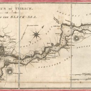
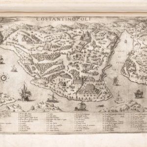
Historical Cartography of the Bosphorus Strait and Constantinople This rare early 19th-century engraved chart presents a strategic nautical rendering of the Thracian Bosphorus, linking the Propontis, or Sea of ...
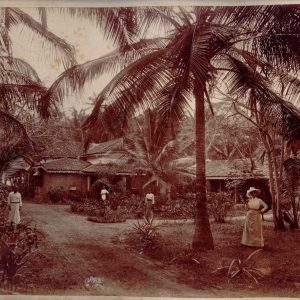
This photograph is an original albumen print, dated circa 1880-1890, depicting the entrance to a European bungalow in Colombo, Sri Lanka (then Ceylon). It is a colonial residence surrounded ...
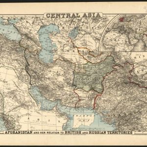
Late Nineteenth-Century Geopolitics and the Great Game in Central Asia Published by G.W. & C.B. Colton, this critical antique political map delineates the volatile regional borders of Central Asia ...
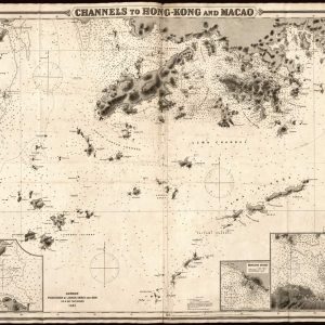
Late Nineteenth-Century Maritime Hydrography of the Pearl River Delta Published in London by James Imray and Son in 1881, this exceptional antique nautical chart captures the intricate maritime corridors ...
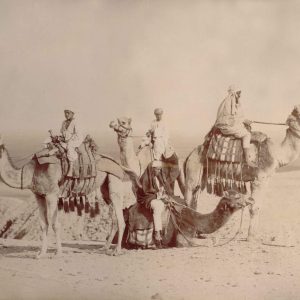
In 1880, Egypt was formally part of the Ottoman Empire but was largely under European influence. Britain and France played major roles in Egyptian politics because of the country’s ...
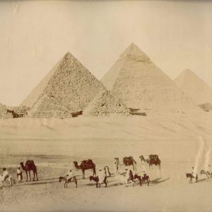
The economy of Egypt in 1880 depended heavily on agriculture, especially cotton exports. The opening of the Suez Canal in 1869 made Egypt a key route for international trade. ...
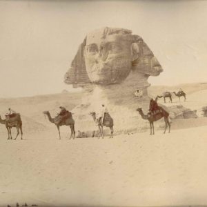
Egyptian society at that time mixed ancient traditions with modern influences. Cairo and Alexandria were lively cities with markets, mosques, and schools, but also growing European communities. Education and ...
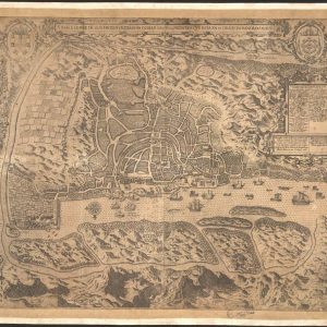
The Island and City of Metropolitan Goa of India Portuguese title: A ilha e cidade de Goa metropolitana da India Jan Huyghen van Linschoten (1563-1611) was a Dutch traveler ...
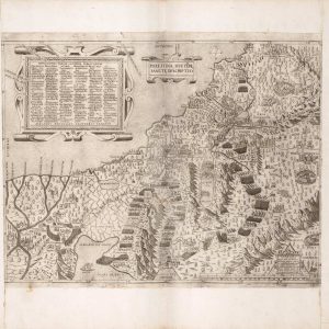
Palestinae sivetere sancte descriptio. English: A holy description of Palestine, or rather.

A striking vintage-style travel poster promoting tourism to “JAPAN,” featuring the iconic national tagline “Land of the Rising Sun.” This retro graphic art print captures the quintessential natural and ...

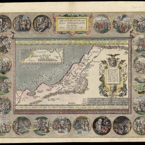
Journey and Life of the Patriarch Abraham This map tracing the life of the patriarch Abraham was published in Antwerp in 1590 by Abraham Ortelius (1527-98), the Flemish publisher ...
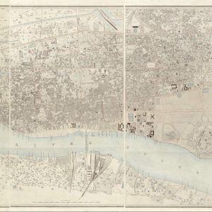
Historical Colonial Survey Map of Calcutta This exceptional antique lithograph represents the comprehensive historical survey of Calcutta, India, executed between 1847 and 1849 by civil engineer Frederick Walter Simms. ...

Historical 1897 Map of China and Southeast Asia This vintage 1897 map by Rand McNally & Co. provides a detailed cartographic overview of East and Southeast Asia at the ...
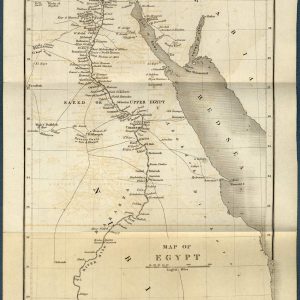
Historical Cartography of the Antique Map of Egypt and the Nile River This beautifully preserved 1844 antique map showcases the geography of Egypt, Nubia, and the surrounding regions, including ...
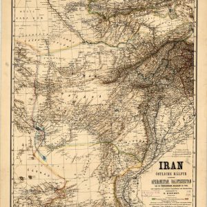
Nineteenth-Century German Cartography of the Middle East and Central Asia This highly detailed antique map, titled “Iran Östliche Hälfte,” was drafted by the renowned German cartographer Heinrich Kiepert and ...
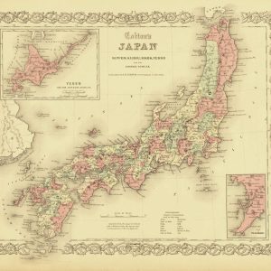
Nineteenth-Century American Cartography of the Japanese Archipelago Published in 1855 by J.H. Colton, this rare antique map offers a detailed geographical survey of Japan during a transformative period of ...
- 1
- 2