Currently Empty: 0,00 €

Seattle to Anchorage Edmonton to Fairbanks to Kodiak to Juneau
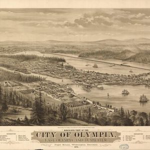
Historic Pacific Northwest Coastline Cartography Immerse yourself in the nineteenth-century heritage of the Pacific Northwest with this stunning reproduction of the 1879 bird’s-eye view map of Olympia, Washington Territory. ...
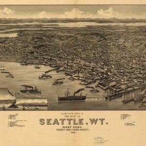
Historic Pacific Northwest Cartography Discover the early days of the Pacific Northwest with this faithful reproduction of the 1884 bird’s-eye view map of Seattle, Washington Territory. This exceptionally detailed ...
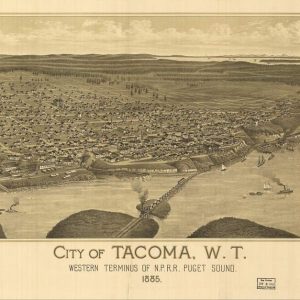
Late Nineteenth-Century Bird’s Eye View of Tacoma W.T. This exceptional panoramic lithograph from 1885 presents a highly detailed bird’s eye perspective of the City of Tacoma during its frontier ...
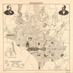
Late Nineteenth-Century Urban Layout of Washington DC This historic street map, published specifically for the Presidential Inaugural Ceremonies on March 4th, 1893, provides a detailed topographical and civic overview ...
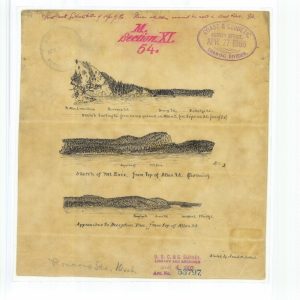
Sketch looking North From camp ground on Allan Island, Sketch of Mt Erie From top of allan Island, Approaches to Deception Pass From Top of Allan Island.jpg