Currently Empty: 0,00 €
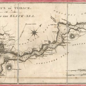
Historical Cartography of the Bosphorus Strait and Constantinople This rare early 19th-century engraved chart presents a strategic nautical rendering of the Thracian Bosphorus, linking the Propontis, or Sea of ...
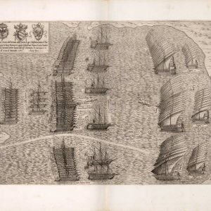
Lordine tenuto dall’armata della santa Lega Christiana contra il Turcho English: The order held by the army of the Holy Christian League against the Turks.
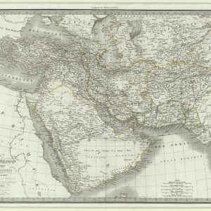
Historical 19th-century map of the Middle East and Southern Asia This detailed antique map focuses on the historic geography of Asiatic Turkey, Persia, Afghanistan, and Arabia. Drawn during the ...
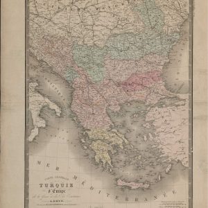
19th-Century French Cartography of the Balkan Peninsula This remarkable historical document offers an intricate look at the southeastern European territories under Ottoman influence, historically referred to as European Turkey. ...
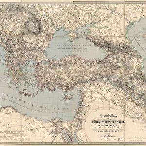
Historical Cartography of the Ottoman Empire This antique map details the vast territorial expansion of the Ottoman Empire during the 19th century, covering strategic regions across Eastern Europe, the ...
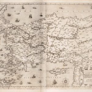
Begnini lettori. Questo disegno rapresenta il naturale della prouincia della Natolia. English: Kind readers. This drawing represents the natural landscape of the province of Anatolia.
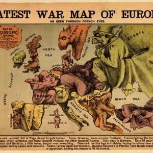
Satirical Map of Europe During the Franco-Prussian War This 1870 satirical caricature map portrays European nations as humorous and aggressive figures during the Franco-Prussian War. Titled as Europe seen ...