Currently Empty: 0,00 €
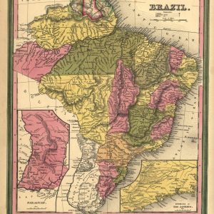
From Henry S. Tanner’s New universal atlas, 1846, p. 40. Available also through the Library of Congress web site as a raster image. Names Tanner, Henry Schenck, 1786-1858.
From Henry S. Tanner’s New universal atlas, 1846, p. 40. Available also through the Library of Congress web site as a raster image. Names Carey, Henry Charles, 1793-1879. Lea, ...
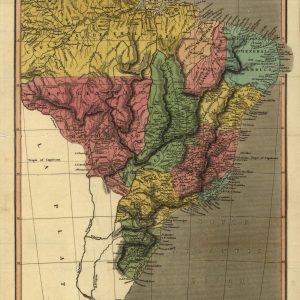
This early map of Brazil is by Jacopo Gastaldi (circa 1500-circa 1565), a Piedmontese cartographer who worked in Venice and rose to the position of cosmographer of the Venetian ...
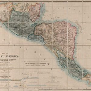
Map of Central America including the states of Guatemala, Salvador, Honduras, Nicaragua & Costa Rica, the territories of Belise & Mosquito, with parts of Mexico, Yucatan & New Granada ...
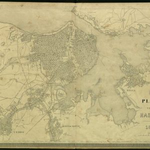
Title: Plano de la Habana Estéban Pichardo (1799-1879) was one of Cuba’s most important figures in the area of scientific research in the 19th century and its leading representative ...