Currently Empty: 0,00 €
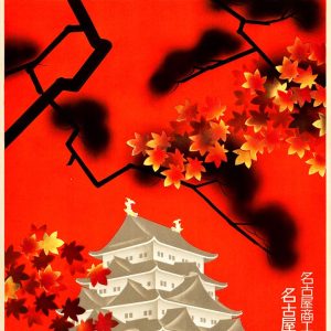
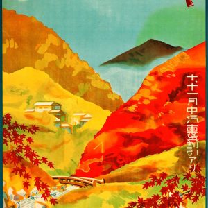
Vintage Japanese travel poster from the 1930s, titled “Autumn in Nagoya”. The poster was originally produced by the Nagoya Tourism Association to promote the city during the autumn foliage ...
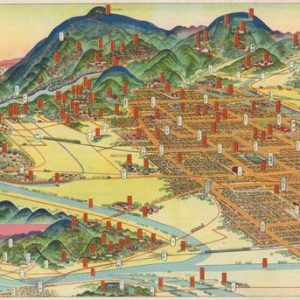
Embrace the cultural timelessness of traditional Japan Step back into the early 20th century with this remarkably detailed Japanese pictorial tourist map of Kyoto and its scenic surroundings. Crafted ...
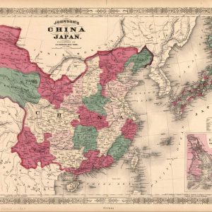
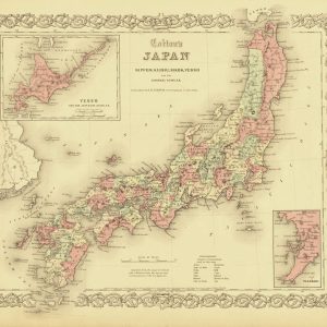
A Masterpiece of 19th-Century East Asian Cartography This authentic 1869 antique map by A. J. Johnson offers a fascinating visual record of imperial China and Japan during a period ...
Vintage Japanese tourist poster, dating from the 1930s. It is part of a series produced by the Board of Tourist Industry of Japanese Railways to promote domestic and international ...
This poster serves as an illustrated and promotional map for Mount Hakusan, one of Japan’s three sacred mountains (along with Mount Fuji and Mount Tate). It was originally produced ...

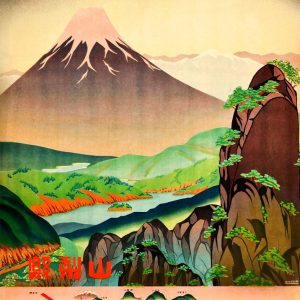
A striking vintage-style travel poster promoting tourism to “JAPAN,” featuring the iconic national tagline “Land of the Rising Sun.” This retro graphic art print captures the quintessential natural and ...
Nineteenth-Century American Cartography of the Japanese Archipelago Published in 1855 by J.H. Colton, this rare antique map offers a detailed geographical survey of Japan during a transformative period of ...
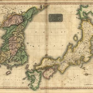
Early Nineteenth-Century Cartography of the Korean Peninsula and Japan This authentic antique map, engraved by Kirkwood and published in 1815 for John Thomson’s New General Atlas, offers a detailed ...

The vintage travel poster in the photo is an advertisement from the Nagoya Rail Agency from the 1930s, highlighting Mount Tate (Tateyama) in Japan. The Japanese text at the ...
This is a Japanese tourism advertisement from the 1930s, titled “Sea Bathing in Obama, Fukui.” It was commissioned by the Osaka and Nagoya Railway Agencies to promote the natural ...
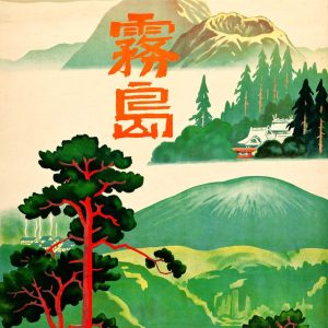
Vintage Japanese travel poster from the 1930s created to promote the Kirishima region in Kagoshima Prefecture. The poster was originally commissioned by entities such as the Japan Railway Agency ...
Vintage Japanese travel poster from the 1930s promoting tourism in the Obama region of Fukui Prefecture, Japan. The poster, issued by the Osaka and Nagoya railway agencies, specifically highlights ...
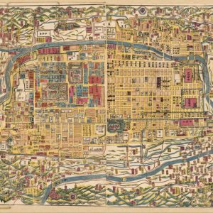
元治新撰皇都細見圖 | Kōto saikenzu Street map of Kyoto, showing temples, shrines, palaces, mansions, etc. Relief shown pictorially in surrounding area. Japanese. Panel title. Oriented with north to the left. ...
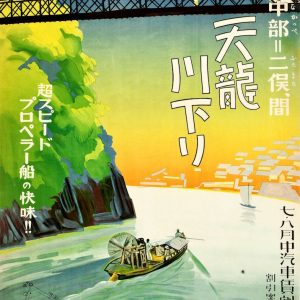
Vintage Japanese tourist poster from the 1930s. It promotes a boat trip on the Tenryu River, specifically the route between Nakappe and Futamata. It was created by the Nagoya ...
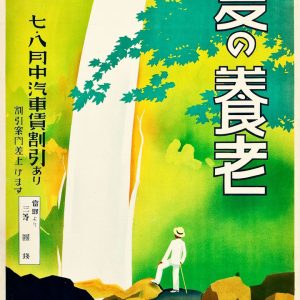
Vintage Japanese travel poster from the 1930s, promoting visits to Yōrō Falls during the summer. The poster was created by the Japanese Government Railways for the Nagoya and Osaka ...
A classic 1930s travel poster promoting Yunoyama Onsen, a famous hot spring resort located in Mie Prefecture, Japan. The image highlights the scenic autumn beauty of the region, featuring ...