Currently Empty: 0,00 €
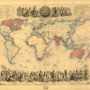
Victorian Era World Map of the British Empire This iconic mid-19th-century colonial chart presents a comprehensive global projection of imperial territories under British rule. The hand-colored antique document utilizes ...
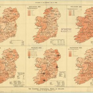
Victorian Thematic Infographics and Demographic Analysis of Ireland This rare 1886 colored lithograph chart showcases an advanced piece of Victorian data visualization, presenting a comprehensive demographic audit of the ...
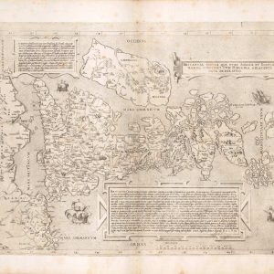
Britanniae insulae quae nunc Angliae et Scotiae regna continet cum Hibernia. English: The island of Britain, which now contains the kingdoms of England and Scotland, with Ireland.