Currently Empty: 0,00 €
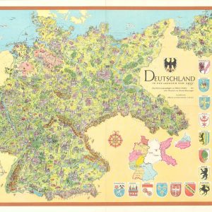
A stunning mid-century pictorial map of Germany, produced as internal and international debate raged regarding the extent and possibility of German reunification. The map shows the German borders in ...
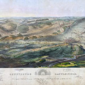
Bird’s eye view of Gettysburg Battlefield – 1863
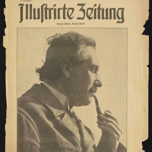
Albert Einstein (1879-1955) on the cover of the Berliner Illustrirte Zeitung, April 23, 1922.
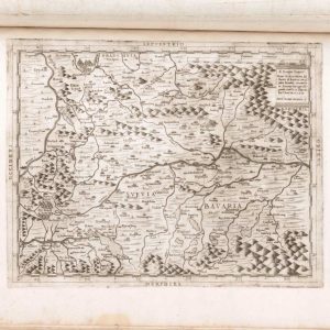
Title: Geografia tavole moderne di geografia de la maggior parte del mondo di diversi avtori raccolte et messe secondo l’ordine di Tolomeo con i disegni di molte città et ...
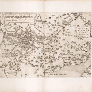
The 16th-century map Galiae Belgicae Romae depicts the Roman province of Gallia Belgica as understood by Renaissance scholars who sought to recover and visualize the geography of antiquity. Created ...
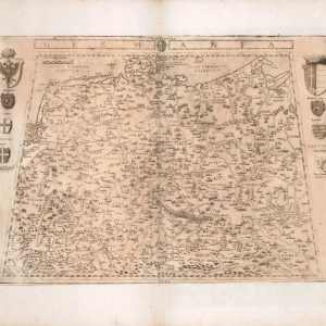
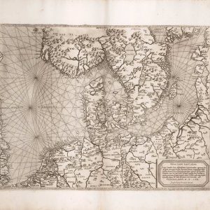
Regionum, Suetiae; Gotiae; Noruegiae; Prussiae; Pomeraniae; Ducatus Megapolensis; Frisiae, English: Regions: Sweden; Gothia; Norway; Prussia; Pomerania; Duchy of Megapolis; Frisia. Suetiae: Refers to the historical region of Sweden, or ...
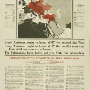
This poster is a classic example of United States propaganda from the time of World War I (circa 1918). It was produced by the Committee on Public Information, a ...