Currently Empty: 0,00 €
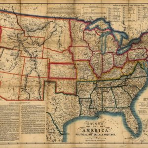
Historical Civil War Map of the United States This antique lithograph showcases a rare 1863 steel plate map of America, subtitled Political, Historical, and Military, published in London by ...
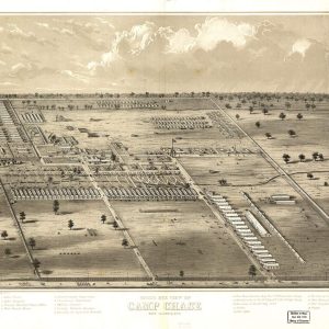
American Civil War Military Encampment Poster Explore the historic layout of Union army training with this rare panoramic illustration of Camp Chase, located near Columbus, Ohio. Originally established during ...
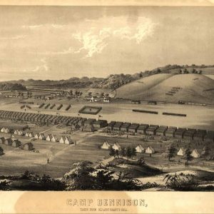
American Civil War Military Print of Camp Dennison This rare 1860s bird’s-eye view sketch portrays the expansive Union Army recruiting and training outpost located near Cincinnati, Ohio. Drawn directly ...
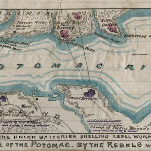
American Civil War Manuscript Sketch of the Potomac River Blockade This rare hand-drawn military manuscript map documents the strategic naval blockade of the Potomac River during the winter of ...