Currently Empty: 0,00 €
John Tallis and Company was a British mapmaking and publishing firm, founded by John Tallis (1817–76), which was active in London circa 1835-60. Tallis maps were known for their ...
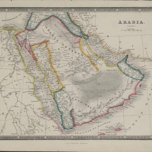
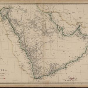
This map of the Arabian Peninsula appeared in the 1856 edition of the world atlas that was first published by James Wyld (1790-1836) in 1824 and in successive editions ...
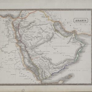
This mid-19th-century British map shows the Arabian Peninsula and neighboring parts of Africa, including Egypt, the Sudan, and Abyssinia. The traditional Greek and Roman division of Arabia into the ...
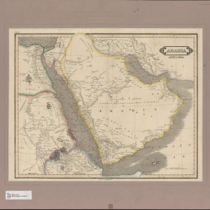
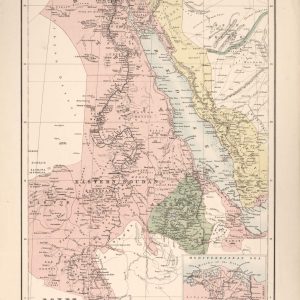
Arabia : with the adjacent countries of Egypt & Nubia. William Home Lizars (1788-1859) was a Scottish engraver and painter and the son of the engraver Daniel Lizars. This ...
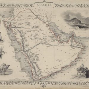
Arabia, the Red Sea and Persian Gulf. This map of the Arabian Peninsula shows international borders, caravan routes, and important cities and towns. British possessions, including the port of ...
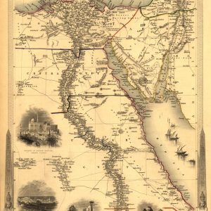
Published in 1851 by J. & F. Tallis. Available also through the Library of Congress web site as a raster image. Names Rapkin, J. John Tallis & Company.
Inset: Suez Canal, scale [1:3.500,000] Available also through the Library of Congress Web site as a raster image. Names Bartholomew, J. G. (John George), 1860-1920.
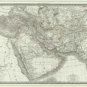
This map, published in Paris in 1831, shows the Asian provinces of the Ottoman Empire, Persia (present-day Iran), Afghanistan, and the Arabian Peninsula. The map appeared in the Atlas ...
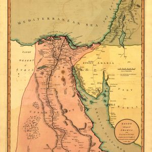
Egypt, with part of Arabia and Palestine. From: A new and elegant imperial sheet atlas, 1803. Available also through the Library of Congress web site as a raster image. ...
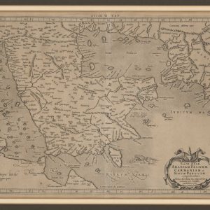
Sixth Map of Asia, including Arabia Felix, Carmania, and the Persian Gulf This map from Ptolemy’s Geographia was published in 1578 and reprinted on many occasions between 1584 and ...
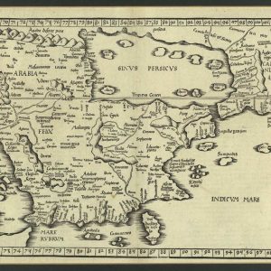
Claudius Ptolemaeus (circa 100–circa 170), known as Ptolemy, was an astronomer, mathematician, and geographer of Greek descent who lived and worked in the Egyptian city of Alexandria. In his ...