Currently Empty: 0,00 €
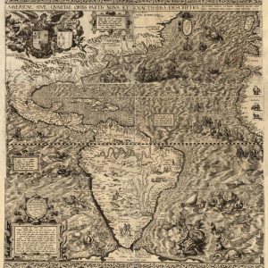
Americae sive qvartae orbis partis nova et exactissima descriptio English title: America, or the fourth part of the world, newly and most accurately described. Names Gutiérrez, Diego, active 1554-1569. ...
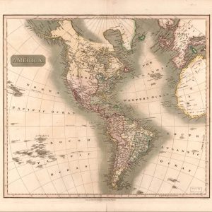
Discover the Art of 19th-Century Cartography Immerse yourself in history with this authentic reproduction of John Thomson’s 1813 masterpiece, capturing the Americas during a defining era of global exploration. ...
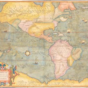
Americae et proximar regionvm orae descriptio. Relief shown pictorially. Prime meridian: Ferro. Second state. Available also through the Library of Congress Web site as a raster image.
This map from Culhuacán in the present-day Delegación de Ixtapalapa, Mexico City, is from the Relaciones Geográficas collection in the Benson Latin American Collection at the University of Texas ...
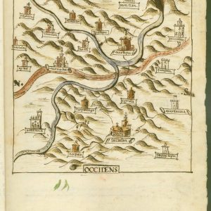
This map from Ixcatlán, Santa María, in the present-day state of Oaxaca, Mexico, is from the Relaciones Geográficas collection in the Benson Latin American Collection at the University of ...
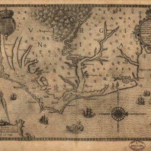
Americæ pars, nunc Virginia dicta : primum ab Anglis inuenta, sumtibus Dn. Walteri Raleigh, Equestris ordinis Viri, Anno Dn̄i. MDLXXXV regni Vero Sereniss. nostræ Reginæ Elisabethæ XXVII, hujus vero ...
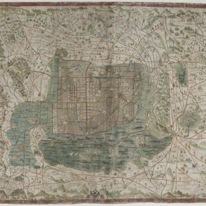
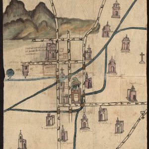
This topographical map of Mexico City and its surroundings dates from around 1550, some three decades after the conquest of the Aztec capital of Tenochtitlán by Hernán Cortés in ...