Currently Empty: 0,00 €

Title: Geografia tavole moderne di geografia de la maggior parte del mondo di diversi avtori raccolte et messe secondo l’ordine di Tolomeo con i disegni di molte città et ...
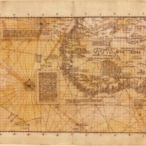
Manuscript copy of sheet 6 of Waldseemüller’s Carta marina Names Waldseemüller, Martin, 1470-1519, cartographer Schöner, Johann, 1477-1547
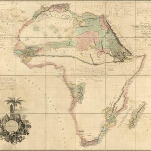
Chart the Dawn of African Interior Exploration Delve into the historic age of discovery with this extraordinary reproduction of Aaron Arrowsmith’s iconic 1802 wall map of Africa. Commissioned during ...
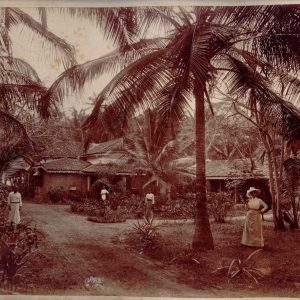
This photograph is an original albumen print, dated circa 1880-1890, depicting the entrance to a European bungalow in Colombo, Sri Lanka (then Ceylon). It is a colonial residence surrounded ...
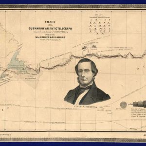
Victorian Telecommunications and the Transatlantic Telegraph Route This exceptional antique chart, published in 1858 by W.J. Barker and R.K. Kuhns in Philadelphia, documents the pioneering engineering feat of laying ...
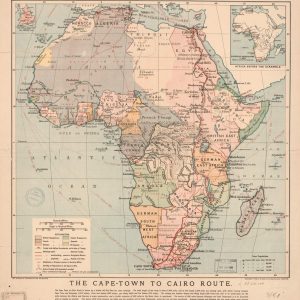
Historical Details of the 1908 African Railway Project This antique commercial map, published by the Daily Mail, illustrates the ambitious British geopolitical plan to connect the continent from south ...
Disigno dell’Isola de Gerb. English: Drawing of the Island of Gerb.

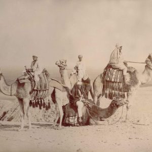
In 1880, Egypt was formally part of the Ottoman Empire but was largely under European influence. Britain and France played major roles in Egyptian politics because of the country’s ...
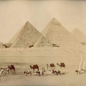
The economy of Egypt in 1880 depended heavily on agriculture, especially cotton exports. The opening of the Suez Canal in 1869 made Egypt a key route for international trade. ...
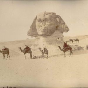
Egyptian society at that time mixed ancient traditions with modern influences. Cairo and Alexandria were lively cities with markets, mosques, and schools, but also growing European communities. Education and ...

L’Europpa, et parte dell’ Affrica. English: Europe and part of Africa.

Map Sampler, An Outline Map of the World for Ladies Needlework and Young Students of Geography, 1798
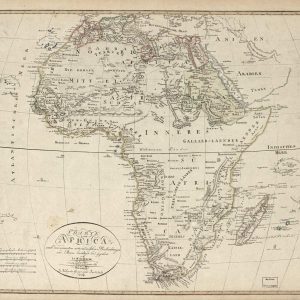
Nineteenth-Century German Cartography of the African Continent This remarkable antique map, titled “Charte von Africa,” was drafted by the German cartographer J.C.M. Reinecke and published in Weimar by the ...
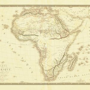
Historical Cartography of the African Continent This antique French map titled Carte de l’Afrique displays the geographical contours of the continent. It highlights major historical regions like the Sahara ...
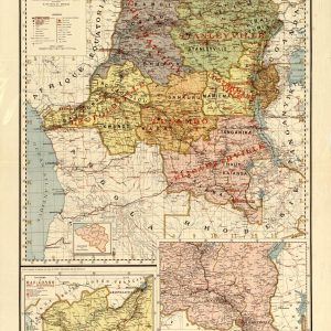
Historical Cartography of the Belgian Congo Region This antique French map displays the colonial territory of the Belgian Congo, showcasing its administrative boundaries and regional divisions. The color-coded document ...
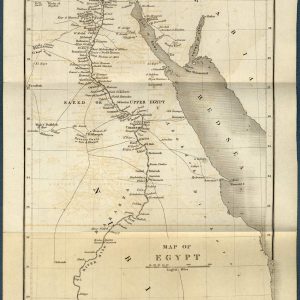
Historical Cartography of the Antique Map of Egypt and the Nile River This beautifully preserved 1844 antique map showcases the geography of Egypt, Nubia, and the surrounding regions, including ...

Historical Map of Liberia and West Africa Coast This 19th-century historical map shows the Republic of Liberia and its vicinity along the West African coast. It features coastal settlements ...
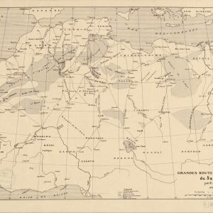
Explore the Historic Trade Routes of the Sahara Delve into the age of exploration with this fascinating 1889 cartographic chart detailing the major commercial routes across the Sahara Desert. ...
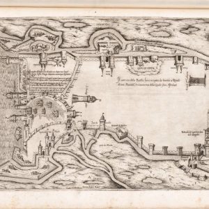
Il vero sito della Rocella. On 16th-century maps, Rocella is the old name for the island of Santiago, which is the largest island in the Cape Verde archipelago. The ...
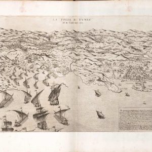
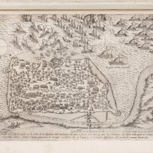
La Presa de Tunis. “La Presa de Tunis” likely refers to a port area or coastal region, as the most relevant research points to the Gulf of Tunis, located ...
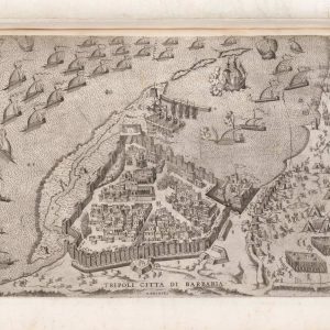
Tripoli citta di Barbaria. English: Tripoli, city of Barbaria. The “Tripoli, city of Barbaria” in the 16th century refers to the city of Tripoli, Libya, as it was then ...
- 1
- 2